Alaska Issues » Bering Sea Ocean Data Sharing Initiative
Bering Sea Ocean Data Sharing Initiative
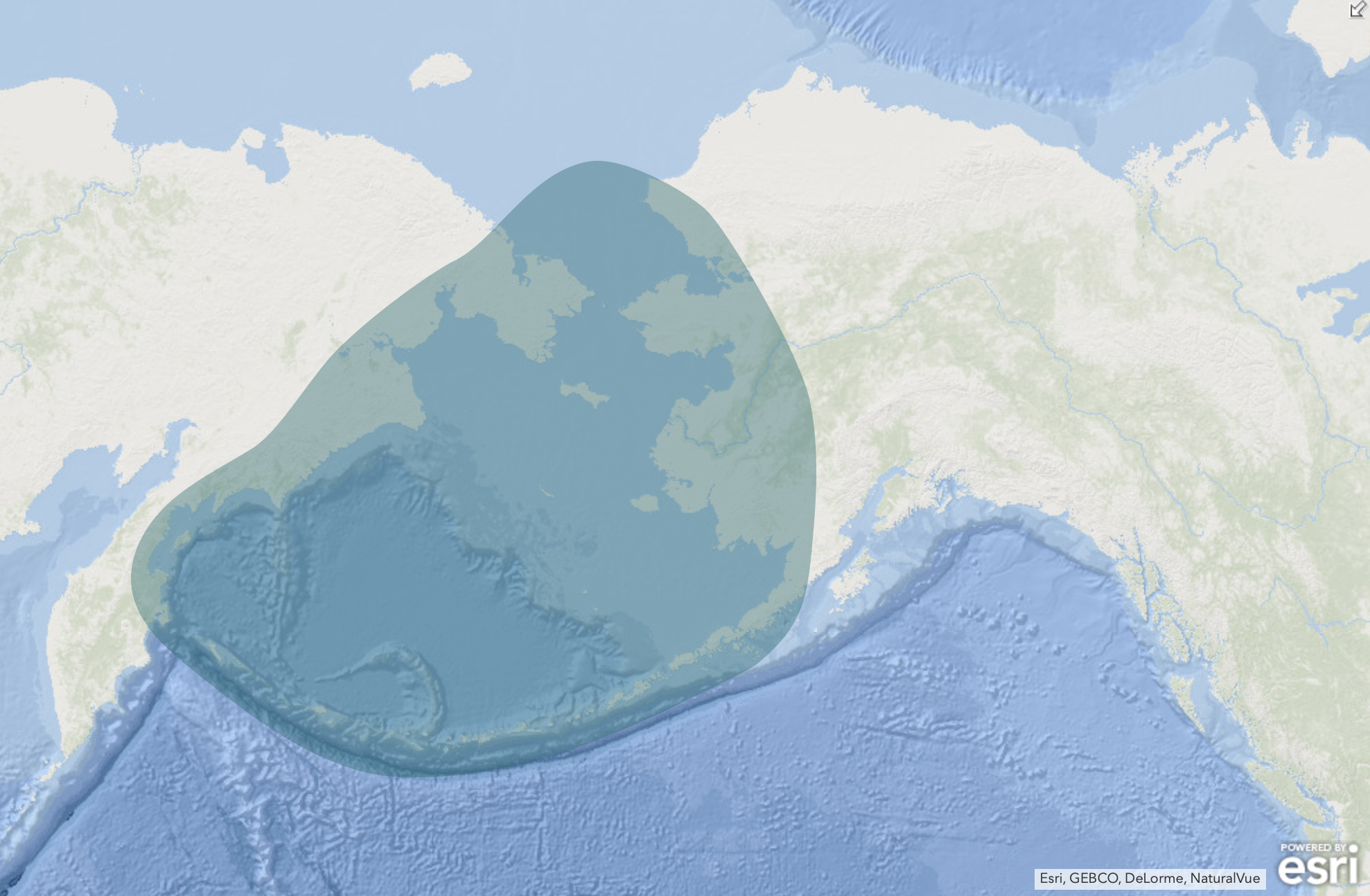
Location of the Data
The Need
Rapid ecosystem changes are being experienced in the Bering Sea, including increased storms causing coastal erosion, loss of sea ice, changing fish distributions, seabird & marine mammal mortalities. All of these affect subsistence and commercial activities in the Bering Sea, impacting people’s food security, safety at sea, and livelihoods.
The Bering Region Ocean Data Sharing Initiative is a collaborative project funded by the IOOS Regional Ocean Data Sharing Initiative. The purpose is to increase sharing of ocean data, and the main goals are to:
- Increase regional data sharing among federal, state, community & private sector partners
- Provide needed information for stakeholder response to rapid ecosystem change in the Bering Sea
- Support agency management & community decision-making, and
- Enhance economic opportunities
Project Location
Project Details
Through this initiative, we are working to ensure that existing data is findable and useable, work with communities, tribes, agencies and stakeholders to identify what information and data products are needed to help with decision-making, and facilitate greater researcher coordination. See the “Project Highlights” below for the activities underway that are part of this initiative.
Project Highlights
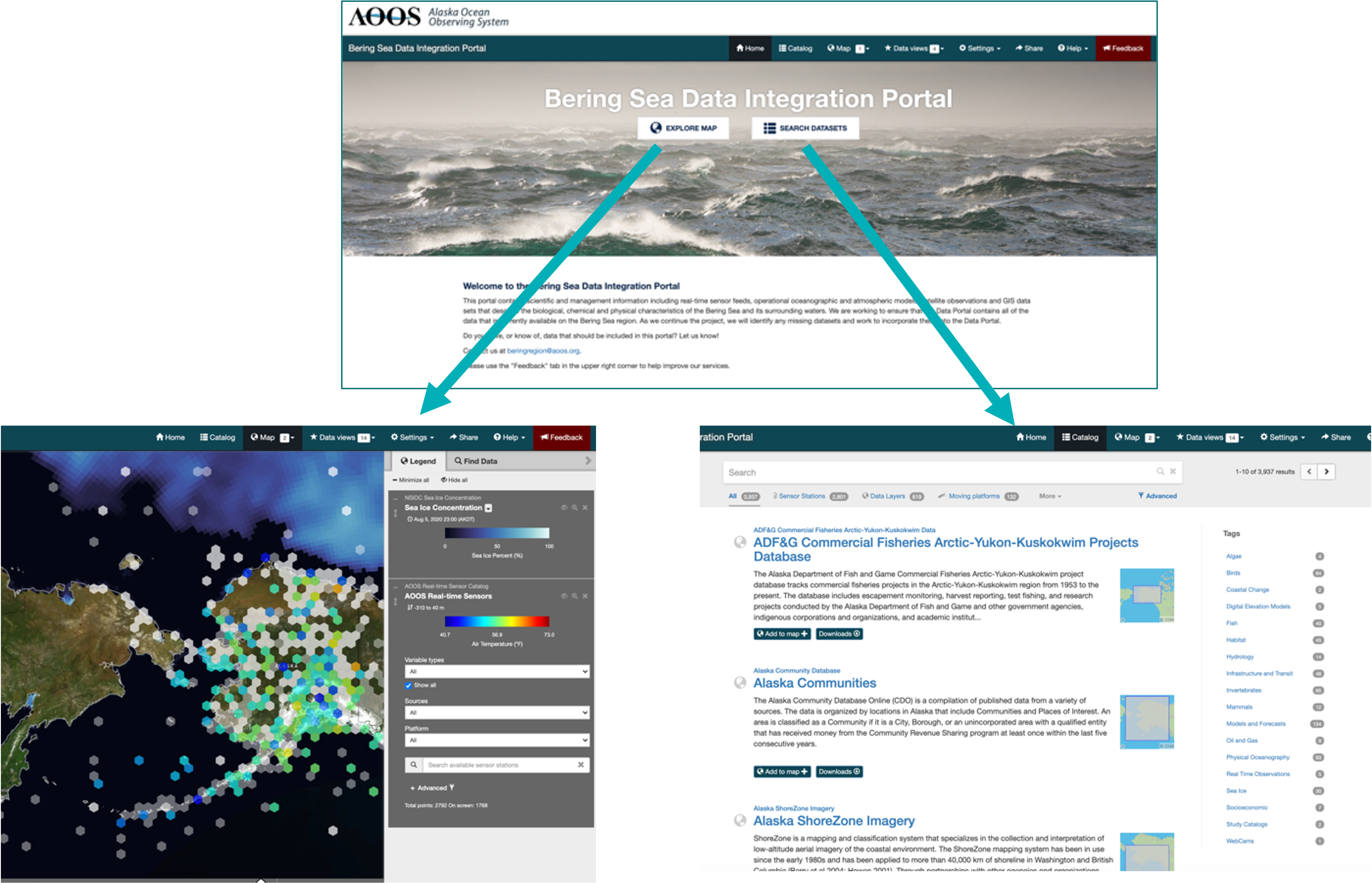
Bering Sea Data Integration Portal
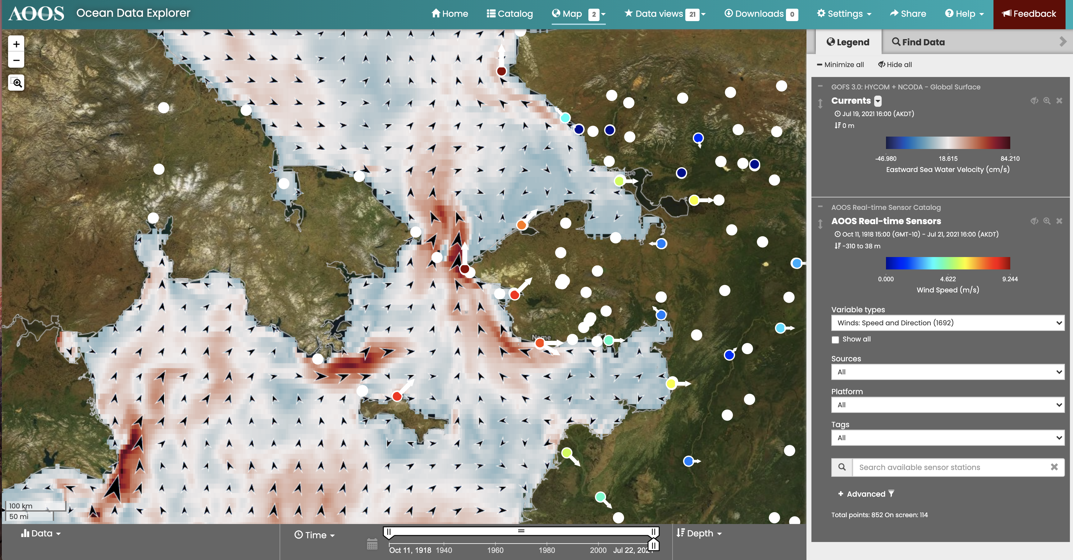
The Bering Sea Data Integration portal contains scientific and management information including real-time sensor feeds, operational oceanographic and atmospheric models, satellite observations and GIS data sets that describe the biological, chemical and physical characteristics of the Bering Sea and its surrounding waters.
Explore the data in the Bering Sea Data Integration Portal
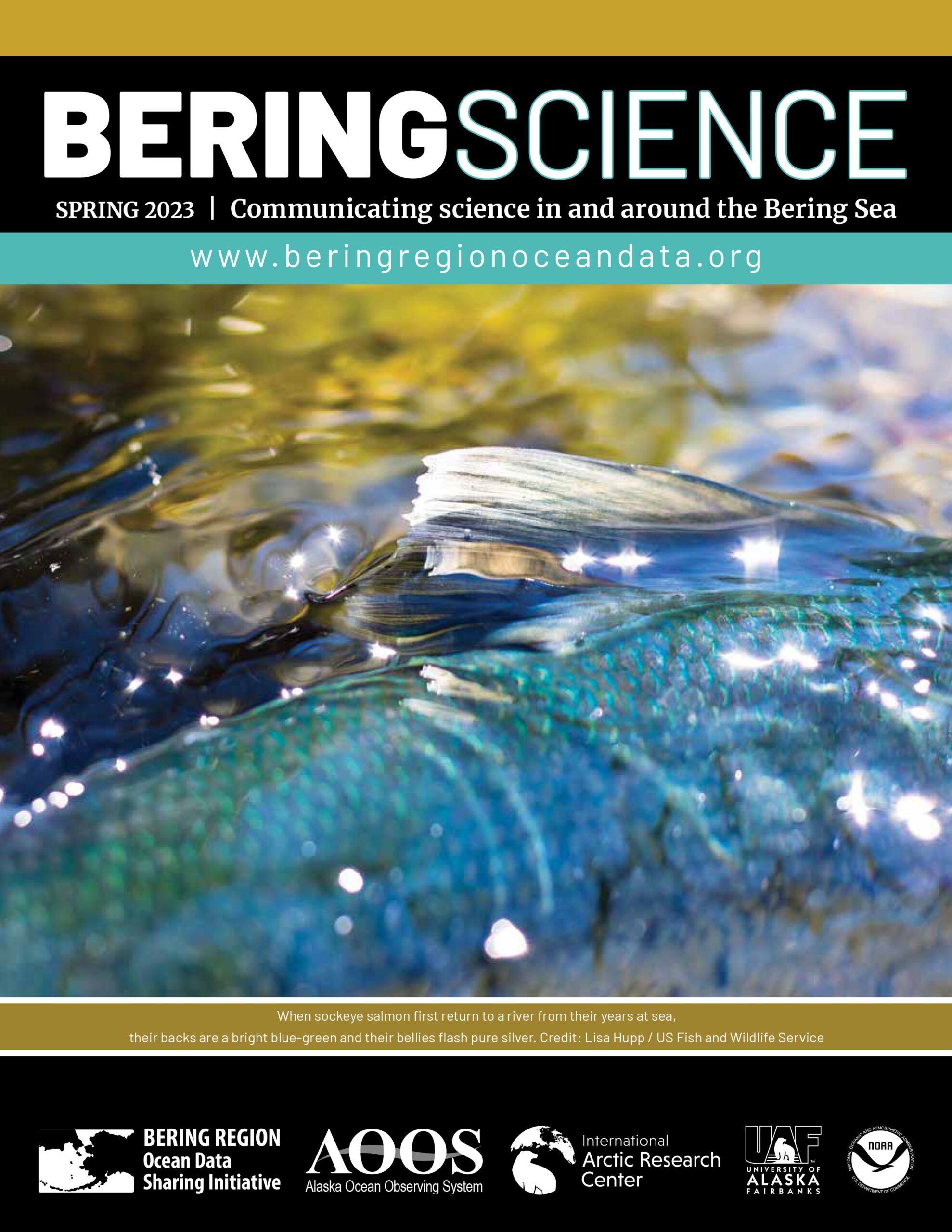
“Bering Science” Publications
The Bering Sea is experiencing many changes. Here, we share observations and research that is happening in and around the region. This year’s report focuses on five topics identified by our Community Advisory Panel. AOOS and International Arctic Research Center compiled the information from many sources, with funding from the National Oceanic and Atmospheric Administration.
The Bering Region Ocean Update project began in spring 2020, in part, to increase regional data sharing among federal, state, community and private sector partners.
If you gather data or have observations of changes in the Aleutians, Bering Sea or southern Chukchi Sea, contact Alice Bailey (bailey@aoos.org) for possible inclusion in a future Bering Science report.
PAST REPORTS
- Watch Past Webinar from Bering Science Spring 2022
- Bering Science: Spring 2022 – Communicating science in and around the Bering Sea
- Bering Science: Winter 2020/2021 – Communicating science in and around the Bering Sea
- Bering Science: Fall 2020 Bering Region Ocean Update – summer science highlights
- Bering Science: Spring 2020 Bering Region Ocean Update
Bering Strait Transboundary Incident Response Tool
As vessel traffic through the Bering Strait increases, there is a greater risk of marine accidents and oil or other contaminant spills in the area. The Bering Strait area also has a lack of infrastructure and resources to respond to incidents of this nature, and there are challenges to communication and data sharing between the U.S. and Russia. For example, the U.S. Arctic Environmental Response Management Application (Arctic ERMA), the U.S. online and field data tool that is used for both planning, prevention and response actions, is stored on U.S. Government servers (i.e., NOAA) and not fully accessible by Russian authorities. For these reasons, there is a need for an oil spill response tool that is accessible by both US and Russian authorities in the event of an oil spill – or some other contaminant spill – in the Bering Strait area.
For these reasons, we are developing a “Bering Strait Transboundary Incident Response Tool.” This tool will co-locate relevant data from the Russian and the U.S. sides of the Bering Strait, as well as the northern Bering and southern Chukchi Seas. The final product will allow for both Russian and U.S. authorities and scientists to access the same data and to share the same visualizations of the area within the Bering Strait region. This information is valuable not only for a potential response to an emergency event such as an oil spill, but will be useful as a public information resource to a broader group of interested parties on both sides of the EEZ, including coastal communities, conservation groups, resource managers and academic researchers.
More information coming soon! Until then, if you have questions, please contact us.
Research Cruise Status
The “Research Cruise Status spreadsheets” were started during the COVID-19 pandemic to inform the community about research cruise status changes. AOOS and the Interagency Arctic Research Policy Committee (IARPC) have put together these spreadsheets during the summers of 2020 and 2021. See the most recent Research Cruise Status information here.
Other Resources & Links
- Alaska Arctic Observatory & Knowledge Hub (AAOKH)
- Alaska Center for Climate Assessment and Policy (ACCAP)
- Alaska Ocean Acidification Network
- Alaska Harmful Algal Bloom Network
- Alaska Sea Grant
- Aleut Community of St. Paul
- Aleutian Pribilof Islands Association
- Bristol Bay Native Association
- Exchange for Local Observations and Knowledge of the Arctic (ELOKA)
- Indigenous Sentinels Network
- Interagency Arctic Research Policy Committee
- Kawerak, Inc.
- North Pacific Fisheries Management Committee
- Bering Sea Fishery Ecosystem Management Plan
- NOAA National Marine Fisheries Service – Alaska Region
- NOAA National Ocean Service
- NOAA National Weather Service
- NOAA Integrated Ocean Observing System (IOOS)
- University of Alaska Fairbanks Ocean Acidification Research Center data resources
Principal Investigators

Jill Prewitt
Alaska Ocean Observing System

Molly McCammon
Alaska Ocean Observing System

John Walsh
University of Alaska Fairbanks

Rob Bochenek
Axiom Data Science
